Cromwell ‘Eye to the Future’ Masterplan- Spatial Framework.
Stage 1- Spatial Plan
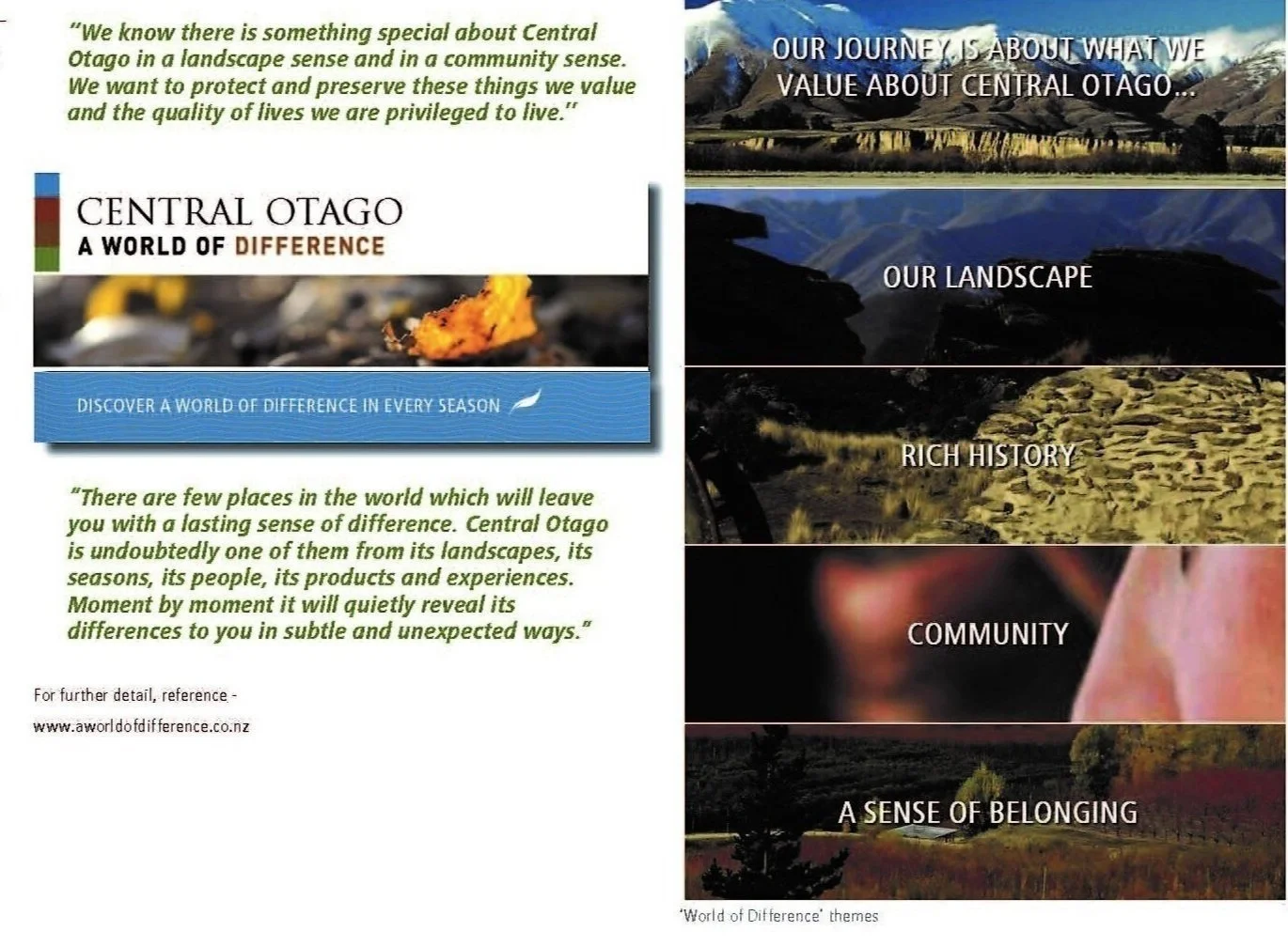
Urban planning to guide the future growth of Cromwell, Central Otago. Key elements of the Plan address land use and urban design to accommodate future development via precinct areas, including that for a mixed use town centre, an arts and culture centre and upgraded civic facilities. The Spatial Plan link is based on a community Vision extablished in the early stages of the the Eye tothe future masteplan project: enabling growth and connectivity in a way that facilitates quality urban spaces and also reflects the significance of the surrounding rural productive environment and Cromwell Basin landscapes. The Plan also reflects unique ‘sense of place values’ and regional identity as described within the Central Otago World of Difference link
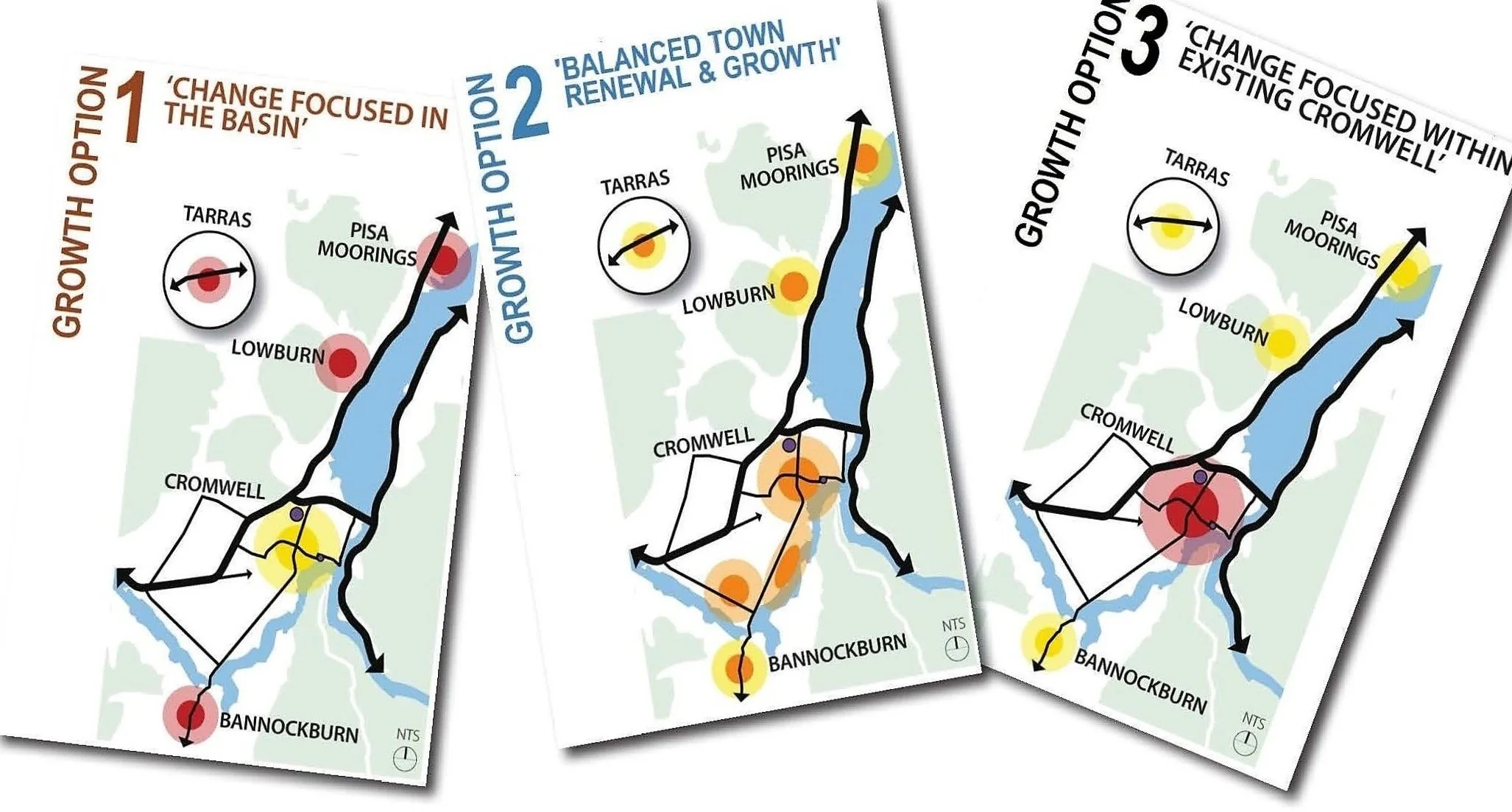
The Spatial Framework/Spatial Plan was one of three workstreams within a masterplanning process which used Investment Logic Mapping and Better Business Case analysis to consider future growth options for the Cromwell township and nearby areas. These areas included Bannockburn, Pisa Moorings, Lowburn and Tarras settlements, and Cromwell’s surrounding rural frame.
Key elements of the Spatial Plan:
urban planning objectives addressing location, type, extent and density of future development and Cromwell’s distinctive setting within the Cromwell Basin,
urban design for a functional urban environment with high quality spaces, aligning with objectives for Smart Growth and sustainability
precinct planning to consolidate urban development within a defined area, cogniscant of the significance of the Cromwell Basin’s rural and tourism economies
measures to upgrade and attract new development within the town centre as a mixed use/multi-functional urban environment
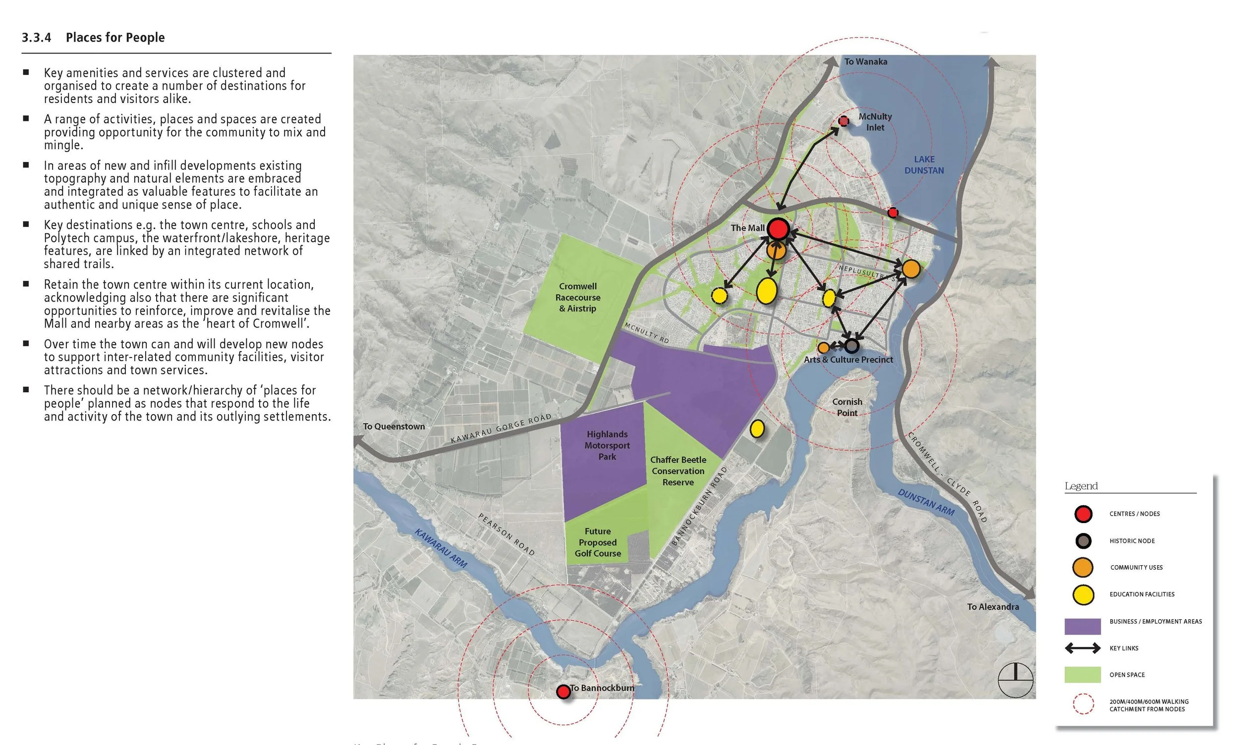
an extended Arts and Cultural precinct to better acknowledge and update past histories, and to enhance the recreational and lesiure offer as an important visitor attraction and community resource. Here the immediacy and overlook to Lake Dunstan is principally conceived as a ‘waterfront’ locale with landmark status accorded also by the significance of the Kawarau and Clutha confluence (and wider locale) to Kai Tahu as mana whenua, Cromwell’s gold mining past and historic settlement, stone buildings, street pattern and alignment.
Project stages
a Vision workshop to establish guiding prinicples to underpin the spatial planning process. For instance Principle 1 is to ‘protect and celebrate the valued landscape,conservation and heritage setting, Principle 2 is to ‘celebrate the horticultural, viticultural and agricultural enviornment, Principles 8 and 10 are to ‘revitalise ‘the town centre to be attractive and lively’, ‘establish Cromwell as a creative town’,
further community engagement assessed a series of long list to short list options as to how future growth should be accommodated to establish an overall development strategy,
with more detailed precinct planning for the town centre and the arts and culture/Old Cromwell locale,
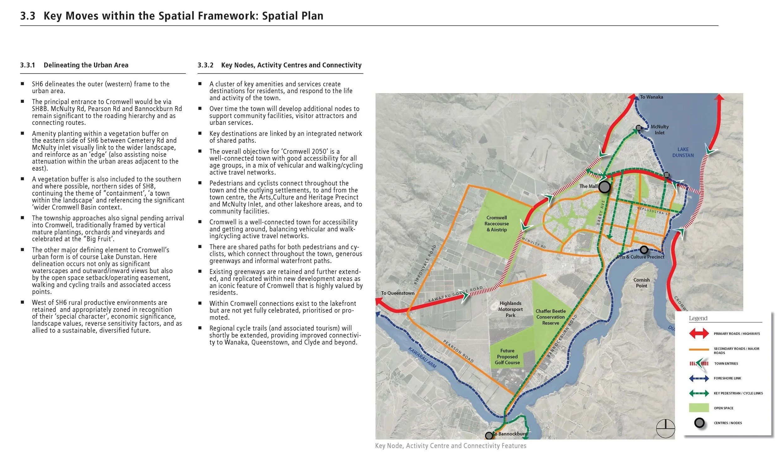
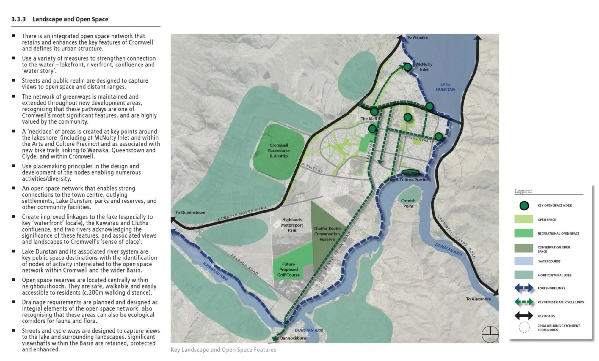
a series of key moves addressed residential infill and density, landscape values and view corridors, authentic character and identity, a definitive rural/urban boundary, retaining Cromwell’s much-valued greenways, improving connectivity to Lake Dunstan, recreation and other community spaces, and future growth within the Outer Settlements,
various measures to give effect to the Spatial Plan were also identified, including via statutory Long Term and Annual Plans, the District Plan review and other initiatives.
NM Associates Ltd + Tract Consultants Pty Ltd.
For Central Otago District Council
Project date: 2016-2017